Pilot programme on Arctic marine environment - NTNU Oceans
-
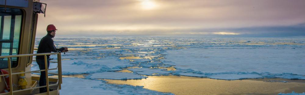
Photo: SAMCot Pilot programme on Arctic marine Environment

NTNU Oceans Pilot on Arctic marine environment
- project addressing Risk, Reliability and Ice data in the Arctic marine environment
Data and knowledge about the marine environment in arctic regions are lacking. How then to achieve a sufficient safety level for humans and the environment at an acceptable cost? Through multidisciplinary research, combining expertise in civil, marine, cybernetics, remote sensing, mechanical, statistics, economy, management, and history, science based tools for rational design of risk and safety in the Arctic Marine and Coastal environment are to be developed. Typical end-users are shipping companies, local communities, oil companies, regulatory bodies, consultants and construction companies.
Reliability methods and long-term data
Reliability methods and long-term data
There are so far four PhD students and two post-docs working here. The main objective is to establish the scientific and engineering basis for methods to estimate structural reliability with respect to available long-term data.
PhD students Ilija Samardzija and Chana Sinsabvarodom both work with probabilistic approach for the design on fixed structures in ice. Ilija addresses a probabilistic model to estimate ice ridge action on fixed structures. He uses a combination of in-situ measurements and knowledge about the relevant physical processes to establish the relevant sea ice ridge statistics. Chana goes deeper in the probabilistic methods and studies the correlation between different sea ice properties and how these can be included in the estimation of ice actions.
Post-Doc Joshua Turner is engaged through the MarTERA project FATICE and tries to answer the questions: Which ice conditions give ice loads and How can we quantify these?
Post-Doc Roghayeh Shamshiri works with satellite-based measurements of ice and tries to understand how Synthetic Aperture Radar (SAR) data, that is sampled roughly every day can be used to estimate long term sea ice statistics of ice thickness, ice drift and ice classification. She will compare statistics derived from SAR with locally measured data from underwater moored Upward Looking Sonars (sampled every second).
The two PhD students Mostafa Hoseini and Mahmoud Rajabi (both at IBM) work in collaboration with the Small Satellite laboratory at NTNU. They both work to support Arctic and Ocean monitoring focusing on the use of hyperspectral camera in small satellites. In addition, the theory and design of a GNSS-R (Global Navigation Satellite System - Reflectometry) sensor is being investigated for ocean observations (sea ice thickness, sea surface height and wave height) and is being qualified for inclusion in NTNU’s SmallSat missions. GNSS-R involves making measurements from the reflections from the Earth of GNSS/GPS satellite signals. The designed GNSS-R sensor provides a high spatiotemporal resolution monitoring of the Arctic and Oceans, as the key components of the Earth’s climate system.
Supervisors are Knut V. Høyland (IBM), Bernt Leira (IMT), Egil Eide (IE) and Hossein Nahavandchi (IBM).
Arctic transport
Arctic transport
When sailing through ice, risk may fluctuate sharply with varying ice conditions, and understanding this risk is important to avoid accidents with a minimal cost.
To support decision making at high latitudes, Sheng Xu, a PhD student at the Department of Marine Technology attempts to link ice conditions, ice loads, and risks. Currently he tries to gain a better understanding of what is happening with ice thickness along the Norther Sea Route as well as to addresses challenges of risk modeling for strategic and tactical planning of Arctic transportation.
Research at the Department of Industrial Economics and Technology Management (IØT) focuses on optimal design and operations of Arctic maritime transportation systems. PhD candidate Mingyu Li uses methodologies such as Robust Optimization and Stochastic Programming to analyze the impact of uncertainty in environmental conditions, such as ice conditions or the duration of the sailing season, on decisions regarding all levels of the transportation system. Examples of relevant problems are fleet-size-and-mix problems, Annual Delivery Plans for LNG, and ice routing problems.
Supervisors are Ekaterina Kim (IMT) and Peter Schütz (IØT).
Coastal infrastructure in a changing climate
Coastal infrastructure in a changing climate
The global warming affects the coastal climate in two ways. First, the increasing air temperatures warm up the permafrost and increase the active layer thickness. Secondly, the decreasing sea ice content gives more open water and a harsher wave climate in coastal waters. These two phenomena enhance the coastal erosion rates and by this threatens the stability and operability of coastal infrastructure such as harbours and terminals.
NTNU collaborates closely with Denmark’s Technical University (DTU) on these topics and four PhD students are engaged in projects related to them. Two of them through the EU Horizon 2020 project Nunataryuk where DTU and NTNU are responsible for the work package on Coastal Structures.
PhD student Hongtao Li (NTNU-IBM/DTU) works with the interaction between waves and sea ice. He developed advanced data-processing techniques to analyse the laboratory-data on wave-ice interactions, which were gathered during the Hydralab+ Transnational Access project: Loads on Structure and Waves in Ice (LS-WICE) conducted in 2016 at Hamburgische Schiffbau-Versuchsanstalt GmbH (HSVA). At first, Li focused on the phenomenon of wave-induced ice-ice collisions and he provided estimates of the contact durations and the restitution coefficients (a measure of energy dissipation). Currently, Li is working on the wave-induced flexural motion of ice floes and the consequent ice break-up du to wave actions.
PhD student Dennis Monteban (DTU/ NTNU-IBM) works with measurements and modelling of Arctic coastal environments. His primary research interest is to utilise remote sensing to improve our understanding of the physical environment of the Arctic and to enhance our ability to model the Arctic environmental conditions. So far, he succeeded in using Sentinel-1 TOPS mode to provide spatiotemporal observations of wave dispersion within sea ice. He applied his new techniques to a study site in the Barents Sea where in-situ data became recently available from the Barents Sea Metocean and Ice Network (BaSMIN) measurement campaign. This measurement program was performed by Fugro, on behalf of Equinor (former Statoil). Currently, Monteban is working on enhancing iceberg drift modelling in the Barents Sea with estimates of icebergs release rates and size characteristics at the major sources in the Barents Sea using Sentinel-1 and Sentinel-2.
PhD student Akshanul Islam (NTNU-IBM) works with numerical modelling of short- and long-term erosion of permafrost coastal bluffs. The primary research interest for Islam is to build a high-fidelity numerical model capable simulating wave transformation in the surf-zone in addition to the thermal and mechanical interaction between the waves and frozen bluffs. The model should be able to reproduce the know Arctic-specific coastal erosion phenomena (i.e., thermoabrasion and thermodenudation) and thus it should be a generic model valid to all sites. The high-fidelity model will be used as a base to derive long-term prediction models. Islam is making a good progress in building the numerical model and recently he participated in field work at Baydaratskaya bay northwest Russia and he gathered valuable data for the validation of his model.
Chuangxin Lyu (IBM) works with field and laboratory experiments to quantify the effect of thawing permafrost on the bearing capacity and mechanical behavior of frozen soil. The field work will be done in Svalbard in close collaboration with UNIS.
Supervisors are Raed Lubbad (IBM), Jens Olaf Pedersen (DTU Space) and Gustav Grimstad (IBM).
Oil spill in Arctic marine environment
Oil spill in Arctic marine environment
Climate change is leading to decline and thinning of Arctic sea ice, potentially increasing the commercial and shipping activities in Arctic marine waters. In addition, expanding maritime activity in the region will likely result in greater seasonal use by tankers and bulk carriers, fishing fleets and cruise ships. This foreseen rise in activity raises additional concerns about the risk of oil spills. Recent interest in developing the rich oil and gas resources in Arctic marine waters will also contribute to increased likelihood of spill accidents.
PhD student Hosseinreza Abbasi (NTNU-IBM) investigates the different physical processes associated with oil spill fate, spread and transport in the Arctic waters. The objective of Abbasi’s PhD study is to develop a novel numerical model to forecast the fate, spread and transport of spilled oil in the marginal ice zone.
Supervisors are Raed Lubbad (IBM), Olga Shipilova (DNVGL)
Charting the Translocal Arctic
Charting the Translocal Arctic
This project gathers scientists to address how Arctic transformations might affect human well-being in global environments.The Arctic region is changing rapidly. These changes are not only material, but also system-wide: Because Arctic biophysical and climatic systems are deeply intertwined with the lifeworlds of the planet, dramatic changes in this sensitive region are likely to be felt elsewhere.
Only sparse knowledge exists about the interconnections between the Arctic’s changing environment and cultural systems of other regions across the world. Such interconnections may be referred to as sharting the translocal Arctic which draws attention to significant interactions within and outside the Arctic.
Understanding the Arctic translocally opens up new understandings of networked environmental effects and the various infrastructures through which its resources and representations are produced and circulated. Thus, this research advances systems-level understanding of links between the Arctic’s rapidly changing environmental, social and cultural systems with other regions and networks across the world.
Arthur Mason project leader
Climate change - its biological and physical consequences
Climate change - its biological and physical consequences
Monthly MOSAiC ridge meeting
Organised by Knut V. Høyland (NTNU) and Mats Granskog (NPI)
The Multidisciplinary drifting Observatory for the Study of Arctic Climate (MOSAiC) expedition was a one-year-long expedition into the Central Arctic (September 2019 - October 2020). For the first time a modern research icebreaker was able to operate in the direct vicinity of the North Pole year round, including the nearly half year long polar night during winter. The German research vessel Polarstern hosted more than 600 people were working in the Central Arctic. The international expedition, which involved more than 80 institutions from 20 countries. NTNU, the departments of Civil and Environmental Engineering (IBM) and Biology (IBI) participated in MOSAiC campaign in the framework of the NFR-funded project HAVOC, the Norwegian contribution to MOSAiC run by Norwegian Polar Institute (NPI).
The MOSAiC expedition created the world’s largest dataset on Arctic sea ice 2019-2020. Unique data sets and new understanding of sea ice ridges were created on the level of individual ridges. We would like to use the monthly ridge meetings to discuss how these and other knowledge on local-scale can be applied to understand and quantify processes on larger spatial and temporal scale. What is the role if ice ridges in the Arctic ice cap?
We hope to engage a wider group of people and perhaps the following two questions could be addressed:
What do the models need? Which data on larger scale can be used?
Those interested in these meetings can contact the organizers.
RareIce
RareIce
Risk of sea ice and icebergs for field development in the Southwestern Barents Sea - RareIce
In the southwestern Barents sea the probability for sea ice and icebergs is very small. In RareIce we argue that the risk for sea ice and icebergs should not be neglected in the design on floating structures.
In standard ocean engineering one carries out local measurements of the ocean environment over some years and applies these measurements to build up a reliable Design base statistic. This procedure is developed and applied successfully in the North Sea.
Main Challenge:
The occurrence of ice is so rare, perhaps once every 1000 years, that it is impossible to establish a statistic from local measurements. The ice in question will form higher north and drift south while transforming. A stochastic framework with which these rare ice occurrences can be included is the final goal.
Our solution:
To quantify ice statistics further north in the Barents Sea and simulate how the ice conditions change as it drifts south, and finally estimate its effect on floating structures.
Approach:
We will use a combination of Measurements and Simulations of physical processes.
We will collect and organize old data and carry out new measurements, both from satellites and from in-situ field work in the Northern Barents Sea.
We will use meteorological and oceanic data and large-scale models of the met-ocean conditions and carry out simulations of the physical processes of how the ice grows, drift and deteriorates as a function of air temperatures, sea currents and temperatures, waves etc. Icebergs originate from glaciers and the birth rate of icebergs from glaciers is one of the larger uncertainties.

RareIce builds on the combined world leading competence from the two CRIs SAMCoT and CIRFA. The partners are NTNU, UiT, Muliticonsult and Equinor.
The project will hire three new PhD student and several other PhD students will be associated to the project.
The main researchers are Knut V. Høyland, Raed Lubbad, Anthony P. Doulgaris, Sveinung Løset, Torbjørn Eltoft, Bernt Leira, Sigurd H. Teigen, Kenneth Johannssen Eik, Tim Fristedt, Nicolas Serré and Åse Ervik.
Knowledge Areas
- Polar resources
- Cooperative marine operations
- Ice monitoring and management
- Robust structures and processing technology
- Safety, risk management, ethics and politics
- Biogeochemical processes